


Approaching Garvald (from Dunsyre)
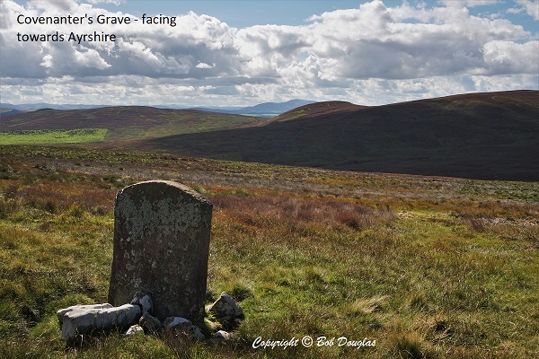 The Covenanters Grave: A few hundred metres before arriving at Garvald an optional detour of about 6km out and back leads to the Covenanter’s Grave. The going can be tough especially in wet conditions where there is no discernible path. The route is marked by line of sight posts.
The headstone on Black Law at NT 0789 5219 marks the spot where John Carphin was buried. He was wounded at Rullion Green but escaped and made his way to the former shepherd’s cottage (now a ruin) at nearby Blackhill. He had requested that, should he die, he be buried within sight of the Ayrshire Hills, his home county. The shepherd, Adam Sanderson, carried his body to a spot where the distant hill of Cairn Table, a little south of Muirkirk, is visible. The present stone was erected in 1841 by the Reverend Dr Manuel of Dunsyre. The inscription reads: ‘Sacred to the memory of a Covenanter who fought and was wounded at Rullion Green Nov 28th 1666 and who died at Oaken Bush the day after the battle and was buried here by Adam Sanderson of Blackhill.” The original stone was inscribed simply ‘COVENANTER DUNSYRE 1666’ and is now located within Black Mount Parish Church
Garvald Bridge: Crossing the Medwin Water is a footbridge whose foundations have been protected by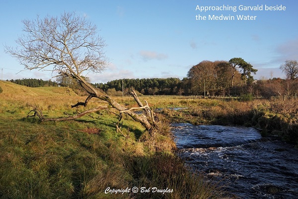 willow spilling planted and maintained by Friends of the Pentlands. Here willow is planted and woven along the banks to prevent erosion. Nearby, in summer sand martins nest in the sandy banks.
At Garvald
Garvald Home Farm with its beautiful 19th century steading and courtyard, comprises nearly 200 acres of land owned and leased by the Garvald Trust. The social enterprise farm established in 1987 enables the community of adults to live and work together to run the farm according to biodynamic principles and includes an education centre.
From Garvald to W Linton
Between Ferniehaugh and Slipperfield Moor can be seen Bronze Age Burial Cairns. The two larger structures date from the second millennium BC and mark an important prehistoric route linking the upper Clyde valley with the Forth estuary.
Just beyond the Upper Cairn the route passes Rumbling Well, the source of the Garvald Burn. This unremarkable spot marks part of Scotland’s national watershed where the Garvald Burn runs south-west and into the Clyde and eventually into the Atlantic and where, about 500 metres ahead, the path picks up the Lowsmeadow Burn which runs into the Tweed and ultimately, into the North Sea.
Beyond Slipperfield the route picks up the old Roman Road which, with its attendant marching camps, was built by the Legions under Agricola about 80AD. It follows the natural route lying to the east of the Pentlands and remained a highway until superseded by the A702 in 1833.
Dunsyre (or Dolphinton) << Garvald >> West Linton